Aus- und Weiterbildung zu KI boomt
Ende 2022 kam Chat GPT auf den Markt. Doch wie kann die sogenannte künstliche Intelligenz in den Alltag integriert und genutzt werden? Kurse zu diesem Thema boomen in der Schweiz.
SRF Interview 17.01.2025
Langform-Radiobeitrag: Hören Sie hier die ausführliche Diskussion zu KI an der HWZ: https://www.srf.ch/play/radio/redirect/detail/e3c84a8c-f57b-3219-b860-5fc494b0826e
Kurzbeitrag in der Tagesschau: Sehen Sie den kompakten Bericht zur steigenden Nachfrage nach KI-Weiterbildung: https://www.srf.ch/play/tv/tagesschau/video/aus--und-weiterbildung-zu-ki-boomt?urn=urn:srf:video:b9b28ff2-db25-4214-bb5e-b7a1e36bb401
"Künstliche Intelligenz revolutioniert unser Leben. Das spüren auch die Zürcher Hochschulen. Hier explodieren die Studierendenzahlen rund um Studiengänge der KI. Waren es noch vor einem Jahr einige wenige, nehmen nun die Zahlen massiv zu."
Die Zahlen sprechen für sich
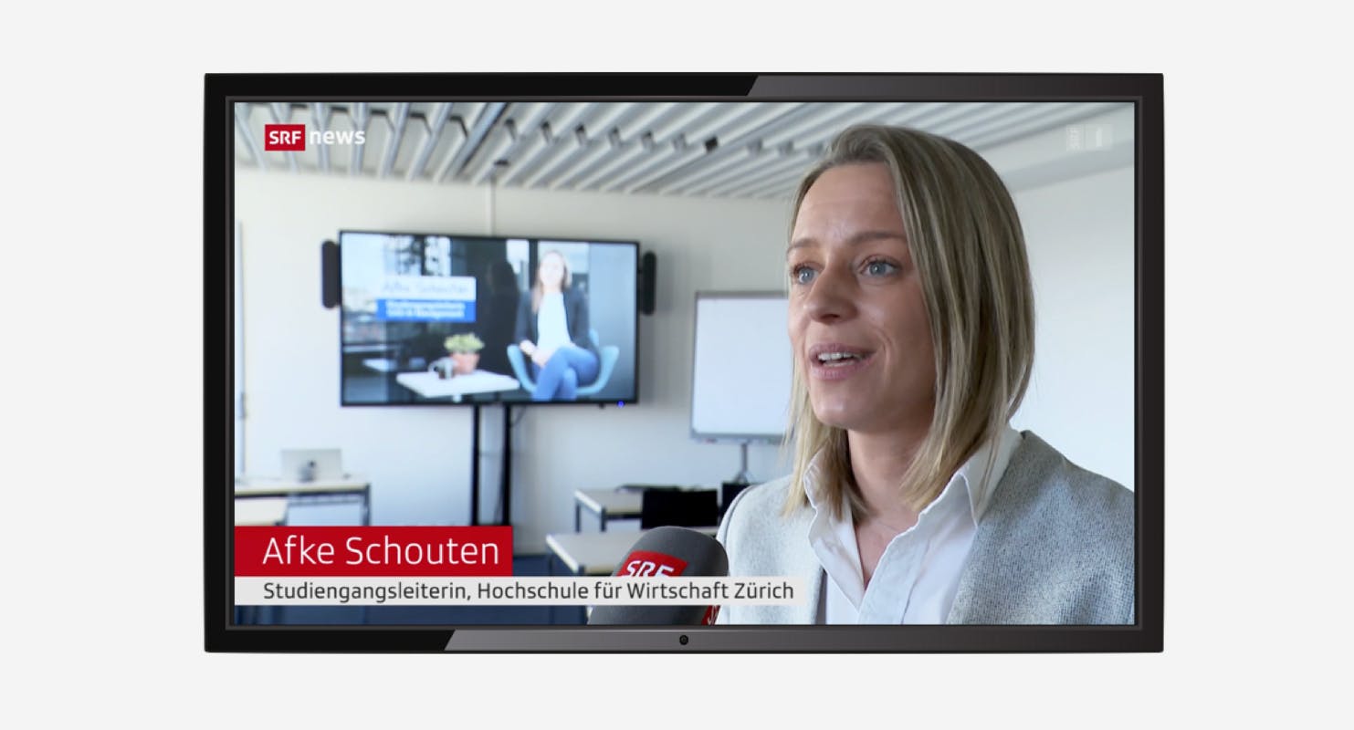
An der Hochschule für Wirtschaft Zürich (HWZ) gab es 2023 lediglich 18 Anmeldungen für Studiengänge oder Weiterbildungen im Bereich KI. Im Jahr 2024 waren es bereits 112 – ein Anstieg von über 520 Prozent. Laut Afke Schouten, Studiengangsleiterin an der HWZ, wird das Thema KI jetzt auch von Fach- und Führungskräften erkannt. "Wir mussten unseren Studiengang, den wir seit 2019 einmal im Jahr angeboten haben, im Jahr 2024 viermal durchführen," erklärt sie gegenüber der SRF Tagesschau.
Warum is Weiterbildung in KI so wichtig?
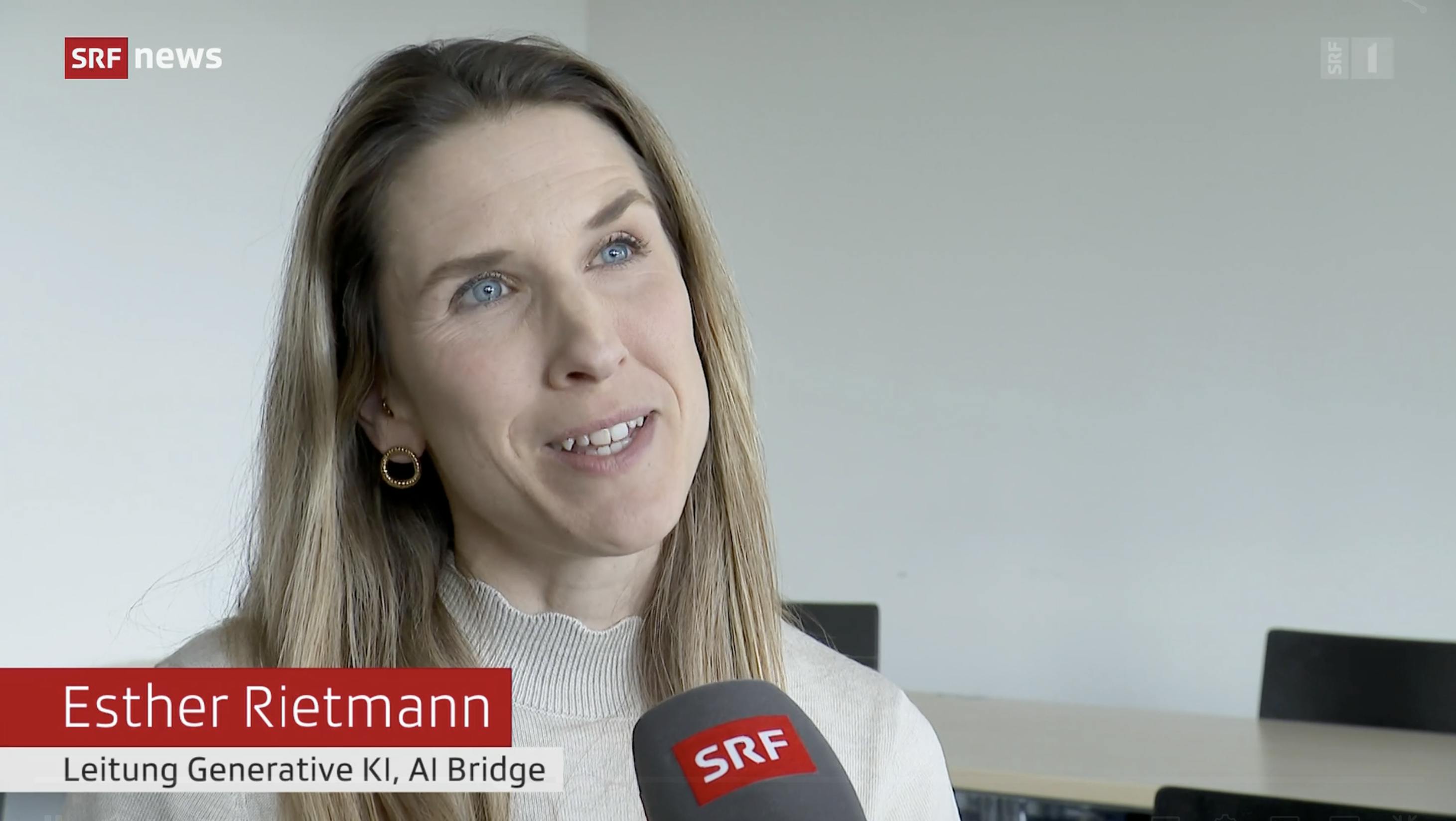
Unternehmen müssen wettbewerbsfähig bleiben und sich an die rasanten technologischen Veränderungen anpassen. Die Nachfrage nach Experten, die KI verstehen und gezielt einsetzen können, steigt unaufhaltsam. Für Esther Rietmann, die in einem KI-Unternehmen arbeitet, ist Weiterbildung eine klare Chance: „Viele Aufgaben, die ich früher manuell gemacht habe, sind heute durch KI automatisiert. Ich sehe das nicht als Bedrohung, sondern als Gelegenheit, spannendere Berufe auszuüben und innovativere Projekte zu betreuen.“
Doch der Einstieg ist nicht immer einfach. "Unsere Studierenden kommen mit der Frage: Wo und wie genau soll ich das Thema KI in meiner Organisation integrieren?" erklärt Afke Schouten. Der rasante Fortschritt und die Vielzahl an Angeboten können überwältigend wirken. Eine gezielte Weiterbildung hilft, diese Herausforderungen zu bewältigen und die ersten Schritte effektiv zu planen.
Die Bildungslandschaft entwickelt sich rasant
Das Thema KI ist so umfassend, dass es oft schwerfällt, den Überblick zu behalten. Laut dem Schweizer Verband für Künstliche Intelligenz besteht eine dringende Notwendigkeit, die Vielzahl an Kursen und Weiterbildungsangeboten zu strukturieren. Sie bieten daher eine Übersicht über die besten Bildungsoptionen. Der erste Schritt für alle bleibt jedoch, sich grundlegend mit dem Thema KI zu beschäftigen und dessen Potenzial zu verstehen.